
.svg)
Drone Technology in Emergency Response
The Growing Role of Drones in Emergency Response
Drones are rapidly becoming indispensable in emergency response operations, providing real-time intelligence, rapid assessment, and data-driven insights when timing and accuracy are critical. Their ability to access remote or hazardous areas gives first responders an advantage that traditional ground operations cannot match. Whether it’s assessing wildfire spread, identifying flood damage, or locating survivors, aerial data helps decision-makers act faster and more effectively in high-pressure situations.
Search and Rescue Operations
In search and rescue missions, drones offer an unparalleled combination of speed, coverage, and precision. Equipped with thermal imaging cameras, zoom lenses, and LiDAR sensors, drones can detect body heat signatures, identify movement, and navigate through rugged terrain where human access is limited. This allows rescue teams to pinpoint the location of missing persons within minutes, even in low-visibility conditions or at night.
Accelerating Time-Critical Missions
When deployed in large-scale disasters—such as avalanches, wildfires, or earthquakes—drones can cover multiple square miles in a fraction of the time it would take a helicopter or ground patrol. They can stream live footage to command centers, enabling emergency teams to coordinate responses and deploy personnel to the most affected zones without delay. The reduced response time often translates directly into saved lives and more efficient resource allocation.
Integrating AI for Smarter Search Results
AI-powered object detection software allows drones to automatically identify people, vehicles, or debris in real time. This automation reduces manual monitoring and increases accuracy during complex searches, giving rescue teams actionable information faster than ever before.
Disaster Management and Situational Awareness
When a natural or man-made disaster strikes, situational awareness is often the first casualty. Drones fill that gap by capturing high-resolution aerial imagery, generating 3D models, and mapping the full extent of damage. Emergency managers use this data to assess infrastructure stability, identify blocked access routes, and plan safe zones for response operations. The same data can also support early-warning systems by continuously monitoring changes in terrain, weather, or structural integrity.
Rapid Damage Assessment and Resource Allocation
Traditional ground assessments can take days or weeks after a disaster. Drones can complete an initial damage survey within hours, allowing agencies to prioritize high-risk areas immediately. Orthomosaic maps generated from drone imagery help visualize flood levels, collapsed structures, or power line damage, which in turn informs where supplies and personnel should be deployed first.
Environmental Monitoring and Data Validation
Beyond immediate disaster response, drones support long-term environmental monitoring. They collect continuous data on erosion, vegetation loss, and contamination levels, helping authorities track recovery progress and validate the effectiveness of restoration efforts. This consistent stream of data ensures that future mitigation strategies are based on accurate, measurable insights rather than estimations.
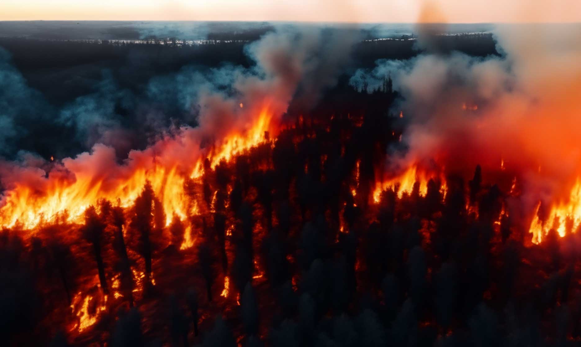
Firefighting and Hazardous Situations
In firefighting operations, drones provide aerial perspectives that human crews cannot safely achieve. They track fire perimeters, identify hotspots using thermal sensors, and guide ground units through smoky or inaccessible regions. For chemical spills or radiation zones, drones eliminate the need for human exposure, capturing critical data safely from above.
Improving Coordination and Communication
Drones integrated into emergency command networks allow teams to share live visual feeds, digital maps, and geotagged updates across departments. This real-time collaboration ensures that all stakeholders—from firefighters to medical teams—have the same operational picture and can act in sync, reducing duplication and confusion on the ground.
Reporting, Analysis, and Future Applications
The usefulness of drones doesn’t end when the crisis subsides. Post-event, the data collected becomes a valuable resource for analysis, insurance assessment, and infrastructure planning. High-accuracy models and annotated maps can help identify patterns, improve future response strategies, and strengthen emergency preparedness programs.
Automation and Predictive Response
The future of drones in emergency response lies in automation and predictive analytics. With AI integration, drones will be able to self-launch during certain trigger events—like seismic activity or severe weather alerts—to collect early data before teams even arrive. Predictive modeling will further enable responders to anticipate damage patterns, optimize routes, and deploy resources proactively rather than reactively.
Building a Smarter, Safer Future
Drones have evolved from simple aerial cameras to essential assets in modern emergency response infrastructure. Their ability to deliver precise, real-time information under extreme conditions empowers organizations to act with greater confidence and efficiency. As technology advances, the integration of drones with GIS mapping, AI analytics, and real-time communication systems will redefine how we protect lives and rebuild communities after disaster strikes.