
.svg)
Orthomosaics
True-to-scale aerial maps for measurement and documentation.
Orthomosaics
Orthomosaics combine thousands of high-resolution drone images into a single, distortion-free map that’s accurate down to the centimeter. Each pixel is georeferenced, allowing you to measure distance, area, and change directly from a visual record of your site.
Talk to a Orthomosaics Specialist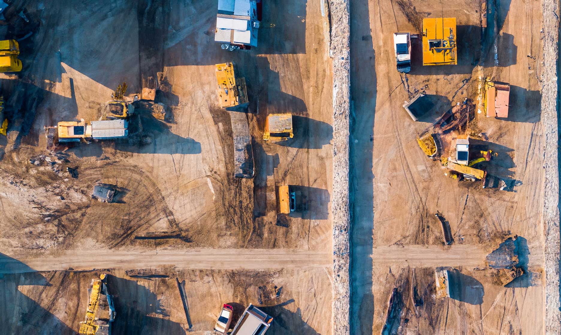
Why Orthomosaics

True-scale accuracy
Orthomosaics are corrected for perspective and distortion, allowing precise horizontal measurements directly from the image.

Consistent spatial alignment
Each deliverable aligns perfectly with terrain models, contours, and previous captures for dependable comparison over time.

Measurement-ready outputs
Measure distances, areas, and offsets confidently using imagery that reflects true ground position.

Reliable visual context
See site conditions clearly—surface features, access paths, utilities, and construction activity—supporting planning, verification, and communication.
How We Create Orthomosaics
The workflow behind true-scale aerial imagery. See how individual photos become a single, accurate site map.
01
Step_01
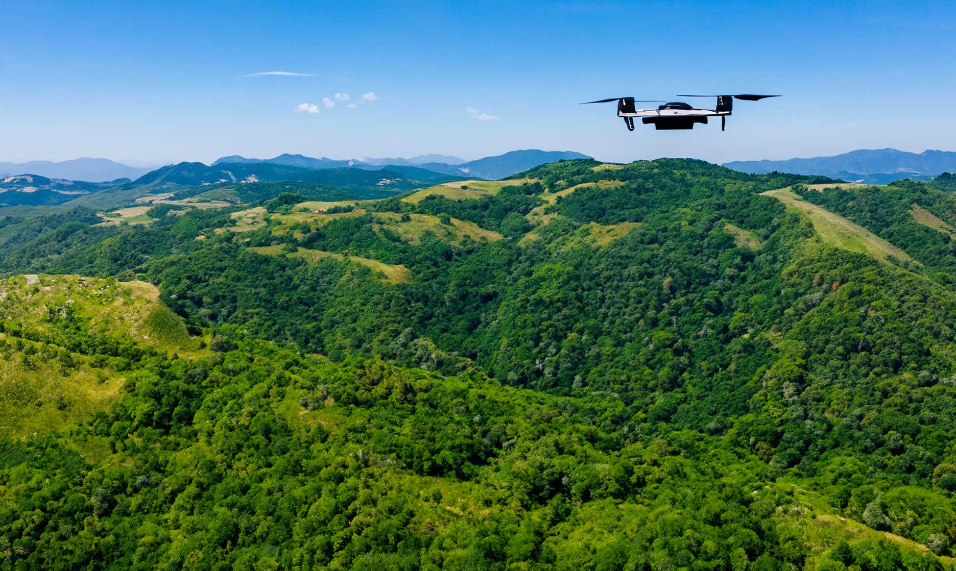
Mission Planning & Control Setup
We define ground sampling distance (GSD), flight altitude, overlap, and coordinate systems based on your accuracy requirements. Ground control and checkpoints are incorporated as needed to ensure the orthomosaic meets survey-grade standards.
02
Step_02
High-Resolution Image Capture
Our drones capture thousands of overlapping images with precise control of camera angle, speed, and lighting. Each flight is optimized to minimize shadows and distortion while maintaining consistent coverage across the entire site.
03
Step_03
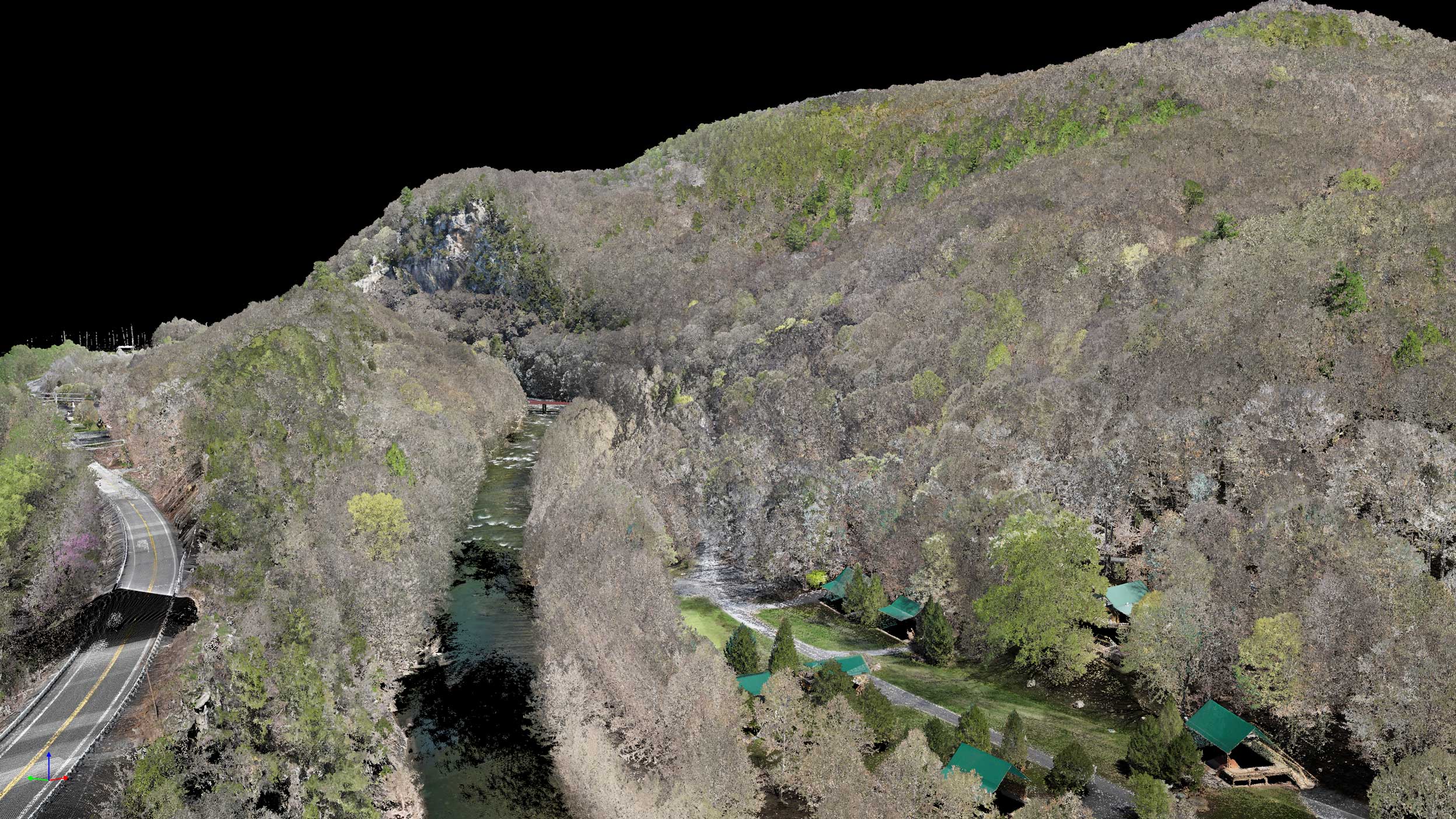
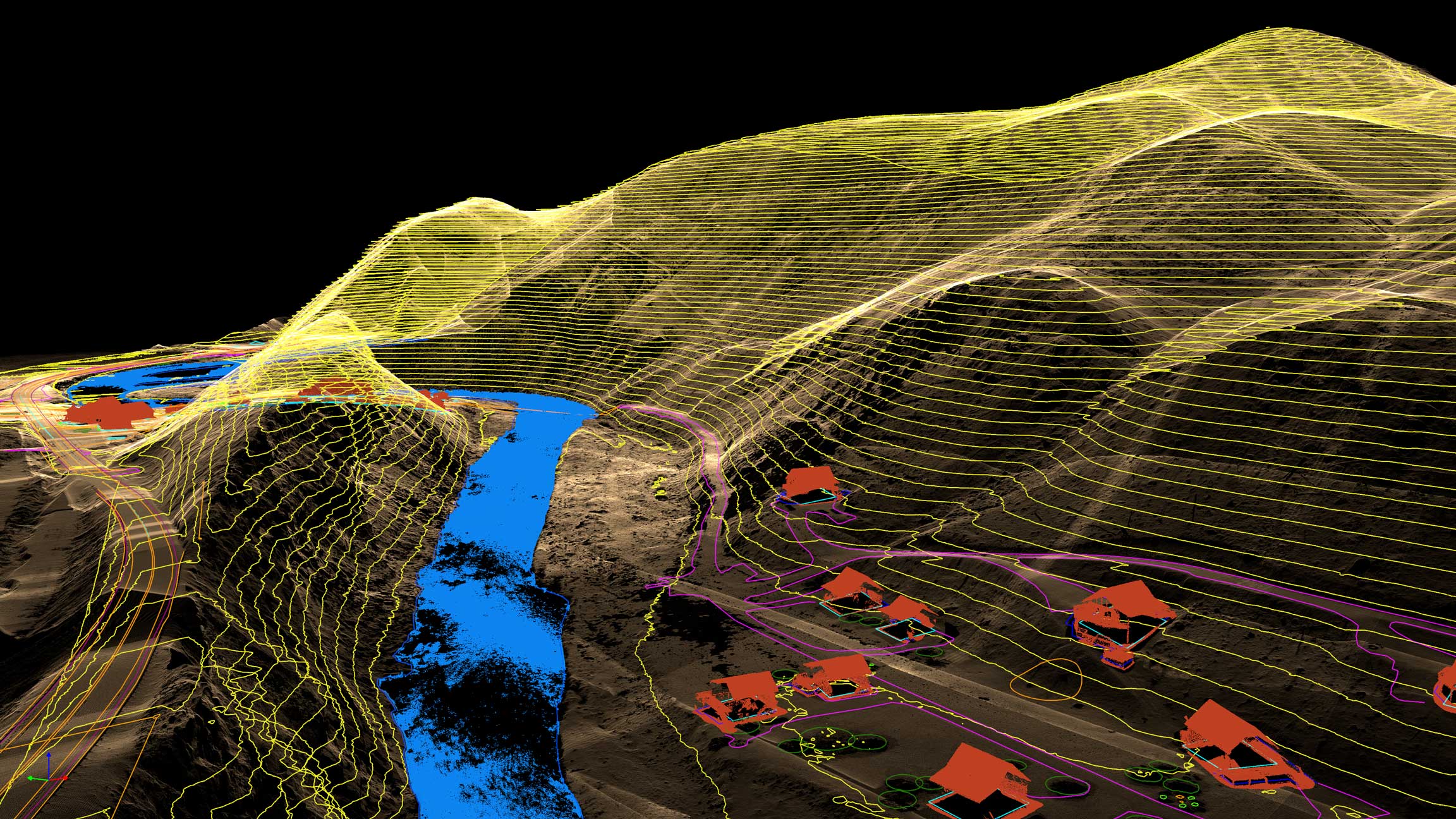
Alignment & Orthorectification
Captured imagery is aligned and corrected for lens distortion, terrain variation, and perspective. We use elevation data to orthorectify each image so every pixel represents its true ground position.
04
Step_04
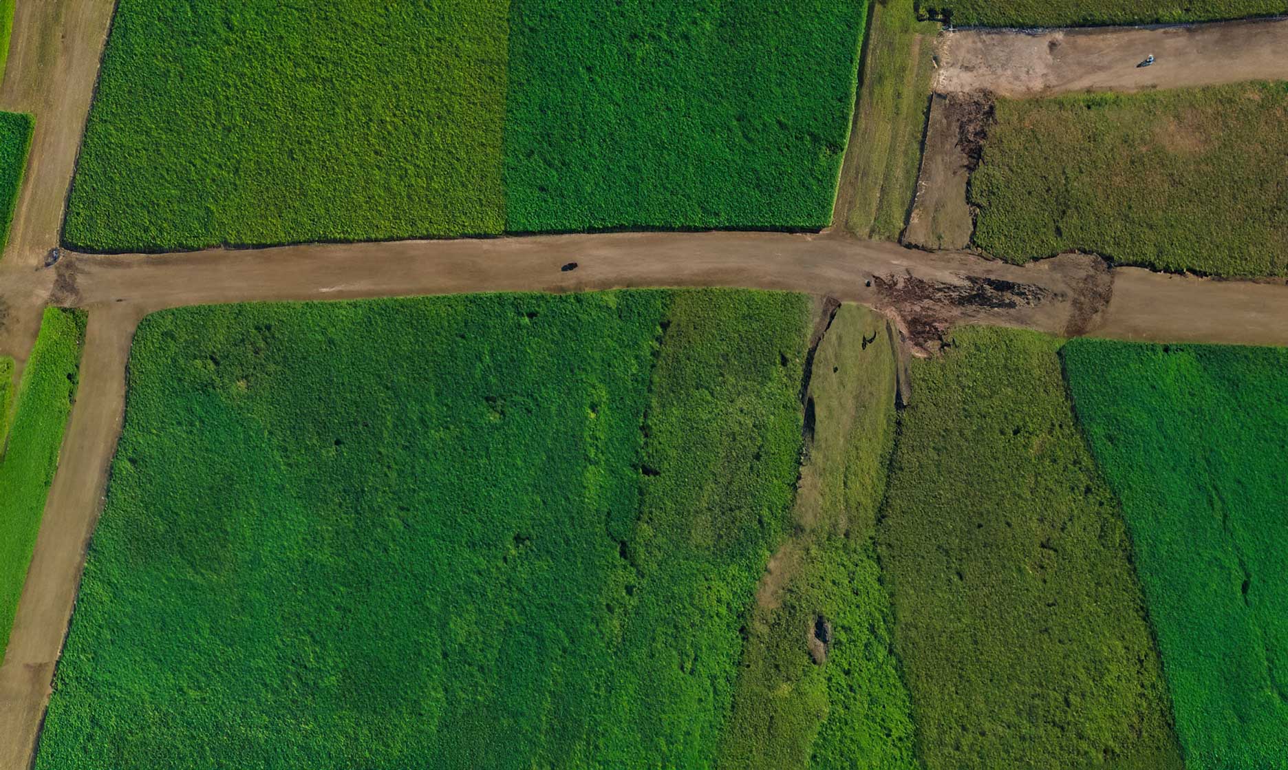
Mosaic Generation & QA/QC
Images are stitched into a seamless, georeferenced orthomosaic and reviewed for clarity, accuracy, and edge consistency. Final outputs are exported in CAD- and GIS-ready formats with validation checks so you can measure and design with confidence.
IT STARTS NOW
Transform your ideas into results
Share your vision with us, and we’ll create the path to make it real.
ContactApplications
Orthomosaics provide a true-to-scale visual record of site conditions, supporting documentation, progress tracking, analysis, and verification across project lifecycles.
Site Documentation & Inspection
Capture existing conditions and surface features with clear visual detail
Construction Progress Tracking
Document change over time and verify completed work
Environmental & Land-use Mapping
Analyze vegetation, land cover, and site impact

Pre- and Post-event Analysis
Compare conditions before and after storms, grading, or major site changes

As-built verification
Validate constructed features against design plans using measurable imagery
Orthomosaics FAQs
Answers to common questions about accuracy, formats, and how orthomosaics are used across design, construction, and GIS workflows.
How long does it take to receive an orthomosaic?
.svg)
What file formats do you provide?
Can orthomosaics be used for measurements?
How accurate are your orthomosaics?
What is an orthomosaic?
IT STARTS NOW
Transform your ideas into results
Share your vision with us, and we’ll create the path to make it real.
Thank you! Your submission has been received!
Oops! Something went wrong while submitting the form.