
.svg)
CAD-Ready Terrain
Accurate surfaces ready for design and engineering workflows
CAD-Ready Terrain
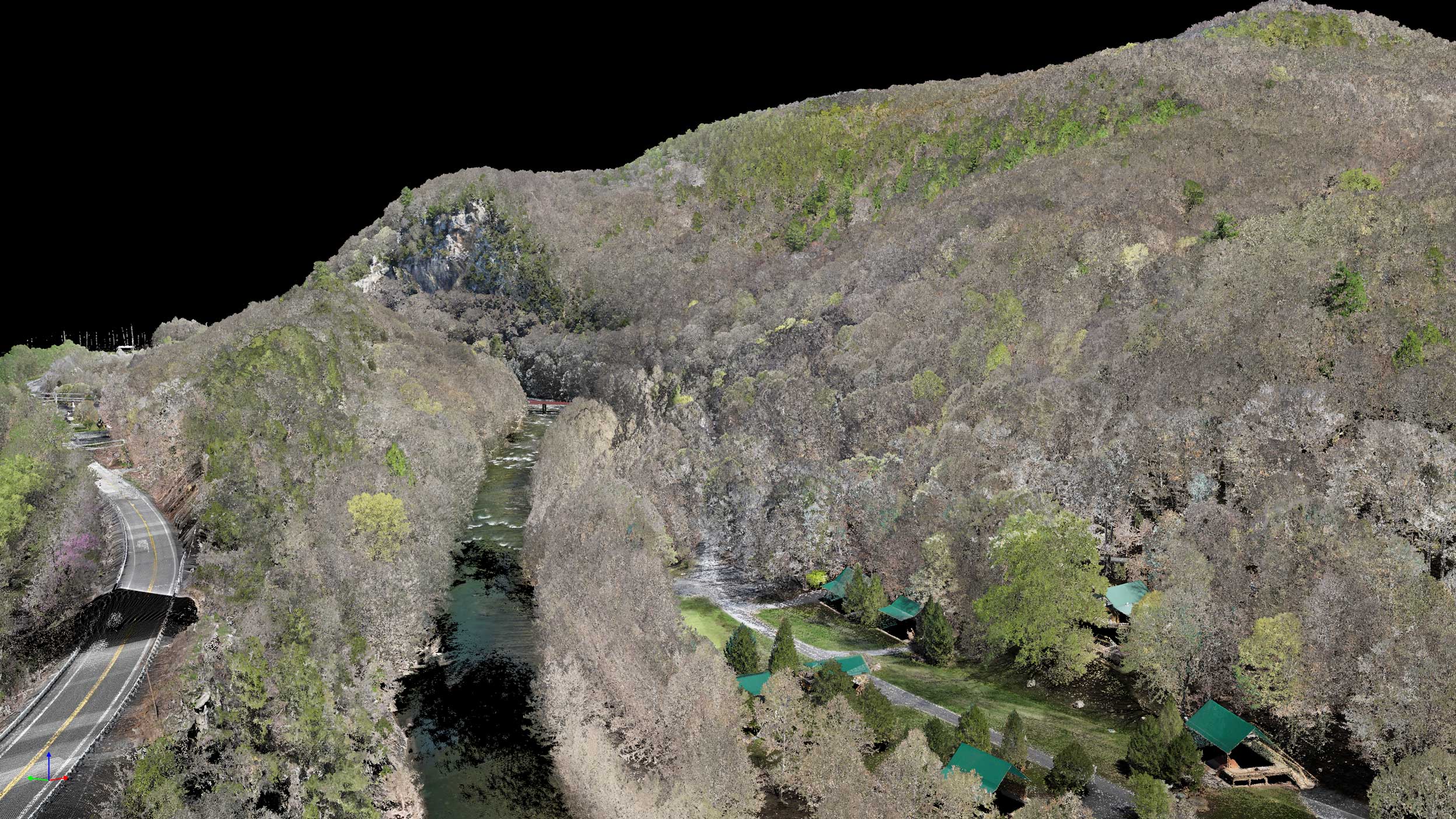
Our CAD-Ready Terrain deliverable converts aerial survey data into high-fidelity digital terrain models built for immediate use in CAD and GIS software. Every surface is precisely aligned, cleaned, and formatted to meet engineering standards—so you can skip the prep work and start designing.
Talk to a Terrain Specialist
Why CAD-Ready Terrain
Survey-grade accuracy
Centimeter-level precision for grading, drainage, and site design.

Clean, classified data
Vegetation and structures removed to produce bare-earth models.

Multiple formats
DWG, DXF, LAS, or GeoTIFF outputs ready for Civil 3D, ArcGIS, and MicroStation.

Custom contours
Generated to your preferred interval and scale.
How We Create CAD-Ready Terrain
The terrain modeling workflow that powers your deliverable. See how raw aerial data becomes design-ready surfaces.


01
Step_01
Requirements & Control Setup
We start by confirming your coordinate system, vertical datum, contour interval, and target accuracy. If you have ground control or checkpoints, we ingest and validate them so the final terrain aligns to your project standards and CAD/GIS environment.
02
Step_02
Data Ingest & Quality Control
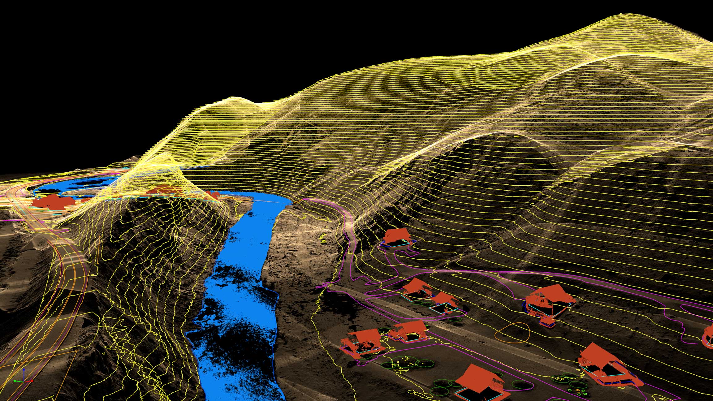
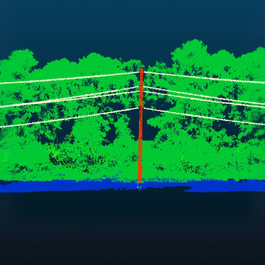
We ingest LiDAR and/or photogrammetry inputs and run coverage checks for overlap, density, and RTK/PPK integrity. Our team flags gaps, removes outliers, and corrects timing or georeferencing offsets so the dataset is stable before modeling begins.
03
Step_03
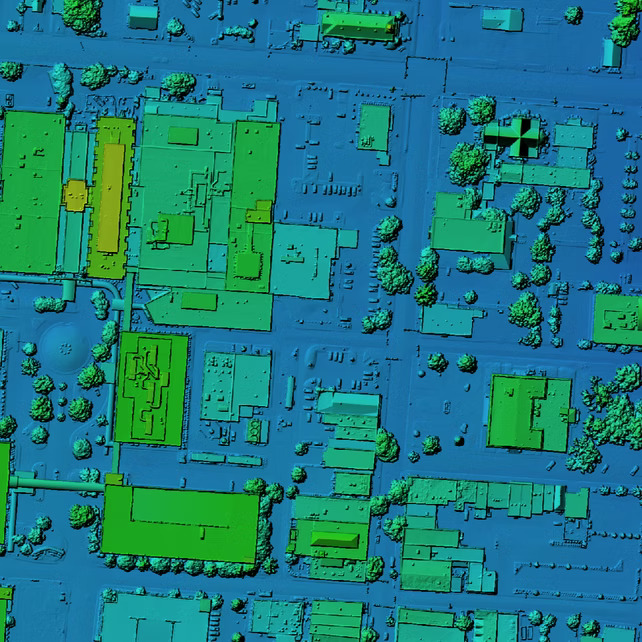
Classification & Bare-Earth Surface Modeling
Next we classify the point cloud (ground, vegetation, buildings, etc.) and isolate bare-earth returns. We apply cleaning, breakline-aware surface building, and smoothing where appropriate to generate terrain surfaces (DTM/DEM), TINs, and contour lines that are measurement-ready.
04
Step_04
CAD/GIS Formatting & Deliverable Export
We export your terrain in the formats you need—DWG, DXF, LAS/LAZ, GeoTIFF, and more—optimized for Civil 3D, ArcGIS, MicroStation, and related tools. Each delivery includes QC documentation (accuracy checks and validation notes) so your team can import and design immediately.
IT STARTS NOW
Transform your ideas into results
Share your vision with us, and we’ll create the path to make it real.
ContactApplications
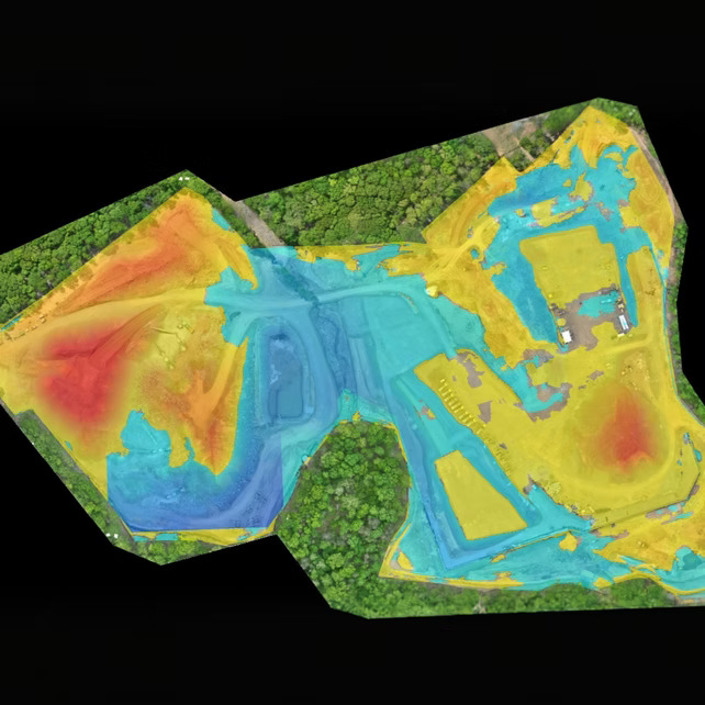
CAD-ready terrain supports grading, drainage, infrastructure layout, and site planning by providing accurate, design-ready surfaces engineers can trust.
Earthwork & Grading Design
Build and refine surfaces for cut/fill analysis and slope optimization
Utility & Infrastructure layout
Design alignments, corridors, and crossings on accurate terrain
Drainage & Watershed Modeling
Analyze flow paths, catchments, and surface behavior
Land Development Planning
Support site layout, access roads, and pad design
As-built Verification & Change Detection
Compare surfaces over time to validate work completed
CAD-Ready Terrain FAQs
Everything you need to know about accuracy, formats, and how our terrain models integrate into your design workflow.
How long does it take to receive CAD-Ready Terrain?
.svg)
How does this compare to traditional ground surveys?
How accurate is CAD-Ready Terrain?
What file formats do you deliver?
What makes terrain “CAD-ready”?
IT STARTS NOW
Transform your ideas into results
Share your vision with us, and we’ll create the path to make it real.
Thank you! Your submission has been received!
Oops! Something went wrong while submitting the form.