
.svg)
Turn Raw Drone Data into Actionable Insights
Advanced Data Processing for Accurate, Ready-to-Use Deliverables
.svg)
Data Pro
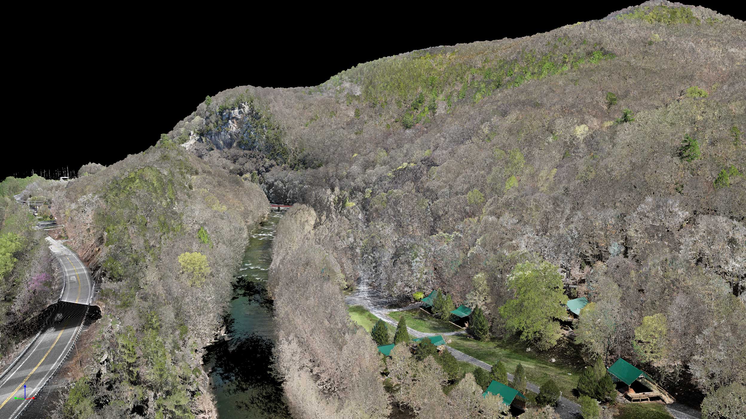
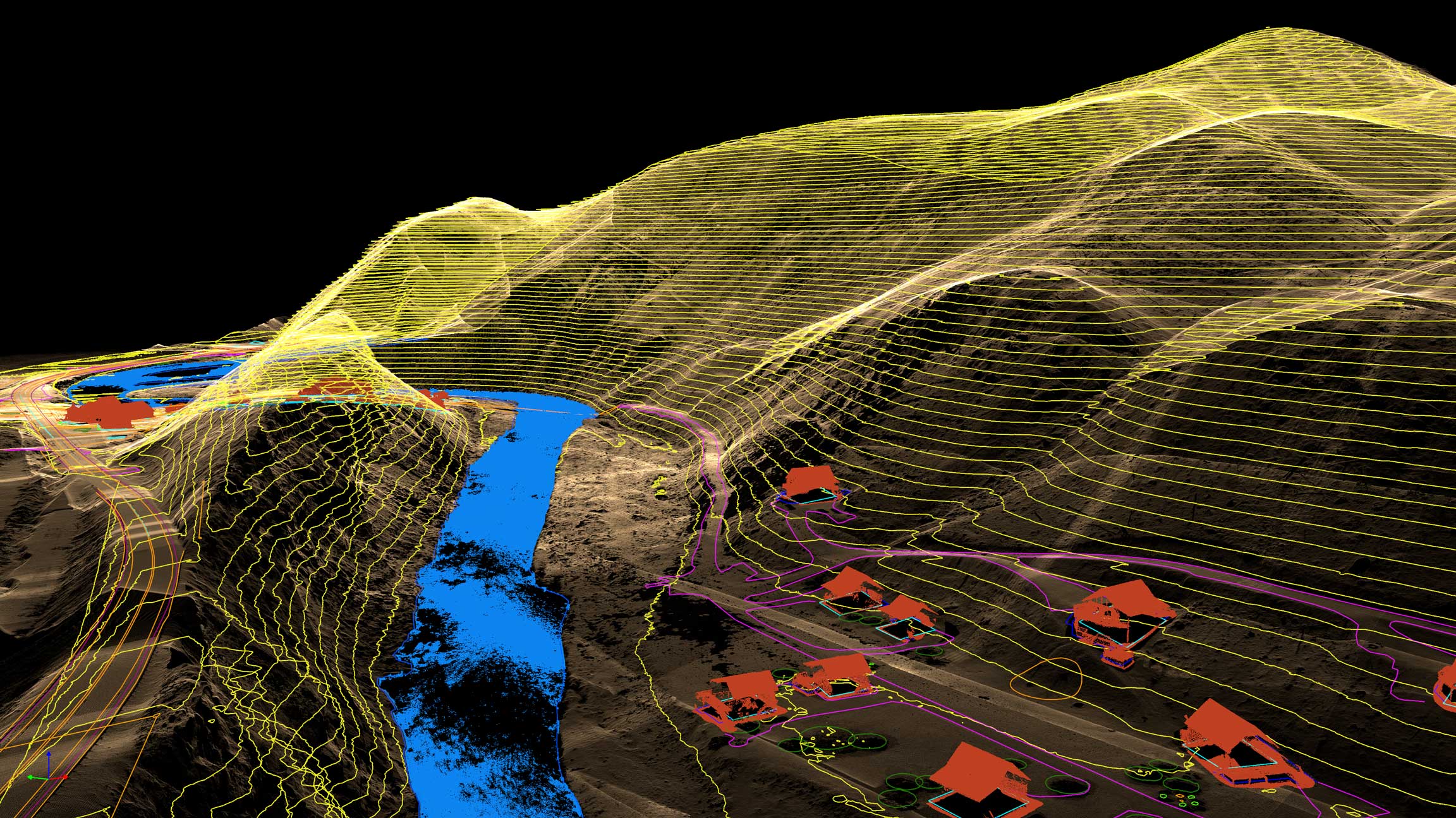
Data Pro handles every stage of your data refinement—from alignment and georeferencing to advanced point cloud processing, surface modeling, and analytics. Our team ensures every output is accurate, consistent, and optimized for actionable insight.
Upload Your Data
Why Data Pro

Seamless Workflow
Our processing pipeline handles everything from alignment and cleaning to classification and export—ensuring your data moves smoothly from capture to deliverable without downtime.

Precision Output
Every dataset is verified for accuracy and consistency. From dense point clouds to contour models, you receive deliverables that meet engineering-grade standards.

Custom Deliverables
We tailor outputs to your project needs—whether that’s surface models, volumetric calculations, planimetrics, or contour maps—ready for direct integration into your workflows.

Fast Turnaround
With optimized processing and automation, we deliver high-quality results in days, not weeks—so you can move projects forward faster and make timely decisions.
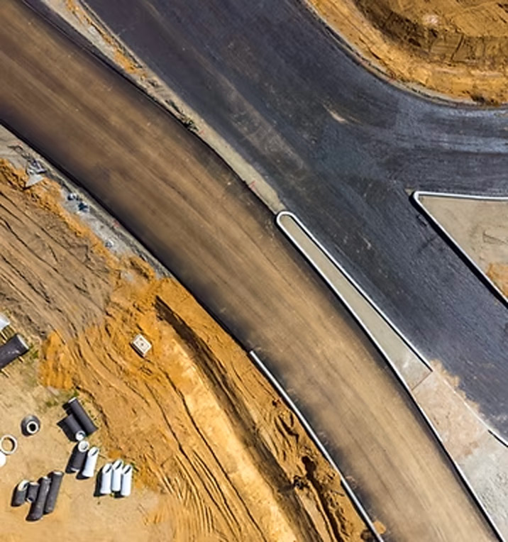
Civil & Surveying
Capture large sites with survey-grade accuracy to support planning, design, and compliance.
.png)
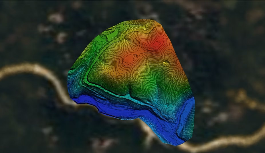
High-resolution Digital Elevation Models (DEMs)
Contour maps for site planning
Surface & terrain analysis
Utility and roadway mapping

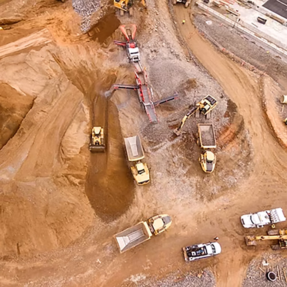
Construction
Monitor progress and maintain project accuracy with frequent LiDAR scans.
As-built verification models
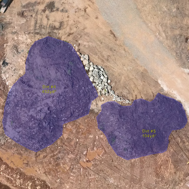
Cut/fill calculations
Stockpile volumes
Change detection over time
Mining & Aggregates
Improve safety and operational efficiency with precise mine and quarry data.
Volumetric stockpile reports
Pit wall and slope stability analysis
Detailed surface TINs/contours
Production tracking
Environmental & Natural Resources
Generate accurate terrain and vegetation data to support conservation and land management.
Vegetation height models
Floodplain mapping
Erosion and watershed studies
Habitat and forestry analysis
Data Processing for Surveying
Process aerial datasets into accurate, georeferenced deliverables including orthomosaics, DEMs, and point clouds. Our workflows ensure precision and consistency across every survey project.
Precision-Processed Deliverables
- Orthomosaics, DEMs, and point clouds refined for accuracy
- Consistent data alignment across multiple capture sessions
- Optimized outputs ready for CAD, GIS, and 3D visualization
3D Surface & Terrain Modeling
- Generate DSMs, DTMs, and contour maps with survey-grade precision
- Visualize surface changes, cut/fill volumes, and terrain flow
- Perfect for site planning, engineering, and volumetric analysis
Notice the difference: Raw data becomes refined, accurate, and fully actionable with Databird’s processing pipeline—ensuring every pixel, point, and model aligns perfectly for your next phase of work.
Data Processing at Any Scale
From small sites to enterprise projects—one seamless workflow.
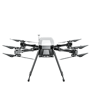
multicopter drone
100’s acres
Efficient capture with multicopter drones for small-to-mid sized sites.
VTOL drone
1000’s acres
Efficient capture with multicopter drones for small-to-mid sized sites.
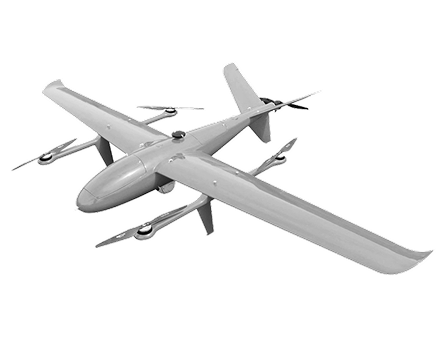
Airplane drone
10,000’s acres
Efficient capture with multicopter drones for small-to-mid sized sites.

How We Process Your Data
The processing pipeline that powers your project. See exactly how raw inputs become accurate, ready-to-use deliverables.


01
Step_01
Requirements & Intake
We start with clear objectives and data intake. Using Data Pro, we confirm coordinate systems, accuracy targets, and deliverable types, then validate flight logs/metadata to ensure the inputs support survey-grade results.
02
Step_02
Ingest & Quality Control
All imagery/LiDAR is ingested and checked for coverage, overlap, RTK/PPK integrity, and anomalies. Data Pro flags gaps, corrects time/geo offsets, and normalizes datasets so multi-day or multi-sensor captures align perfectly.
03
Step_03
Processing & Modeling
We run alignment, georeferencing, and dense reconstruction to generate point clouds, orthomosaics, DSM/DTM, contours, and volumes. Data Pro applies cleaning, classification, and noise reduction for consistent, measurement-ready outputs.
04
Step_04
Feature Extraction & Delivery
From the processed models we extract planimetrics, breaklines, stockpile volumes, and other site features. Deliverables ship in CAD/GIS-ready formats with accuracy reports—so your team can plan, measure, and act with confidence.
IT STARTS NOW
Transform your ideas into results
Share your vision with us, and we’ll create the path to make it real.
ContactIndustries
Civil and Surveying
Deliver high-accuracy topographic maps, digital elevation models, and geospatial data that streamline surveying workflows, reduce field time, and support smarter design decisions.
High-resolution Digital Elevation Models (DEMs)
Contour maps for site planning
Surface & terrain analysis
Utility and roadway mapping

Construction
Monitor progress and maintain project accuracy with frequent LiDAR scans.
As-built verification models
Cut/fill calculations
Stockpile volumes
Change detection over time
Mining & Aggregates
Improve safety and operational efficiency with precise mine and quarry data.
Volumetric stockpile reports
Pit wall and slope stability analysis
Detailed surface TINs/contours
Production tracking
Environmental & Natural Resources
Generate accurate terrain and vegetation data to support conservation and land management.
Vegetation height models
Floodplain mapping
Erosion and watershed studies
Habitat and forestry analysis
Data Processing FAQs
Get answers to the most common questions about data processing, from workflows and deliverables to accuracy and turnaround time.
How accurate are Data Pro deliverables?
.svg)
What makes Data Pro different from other processing tools?
How fast can I get results with Data Pro?
What deliverables will I receive?
What types of data can I submit?
IT STARTS NOW
Transform your ideas into results
Share your vision with us, and we’ll create the path to make it real.
Thank you! Your submission has been received!
Oops! Something went wrong while submitting the form.