
.svg)
Volumetrics
Accurate volume measurements for earthwork, stockpiles, and material tracking.
Volumetrics
Volumetric deliverables transform 3D surface data into precise measurements of material quantities across your site. Whether tracking earthwork progress, managing stockpiles, or comparing surveys over time, every calculation is grounded in survey-grade accuracy for confident decision-making.
Get Accurate Volume Data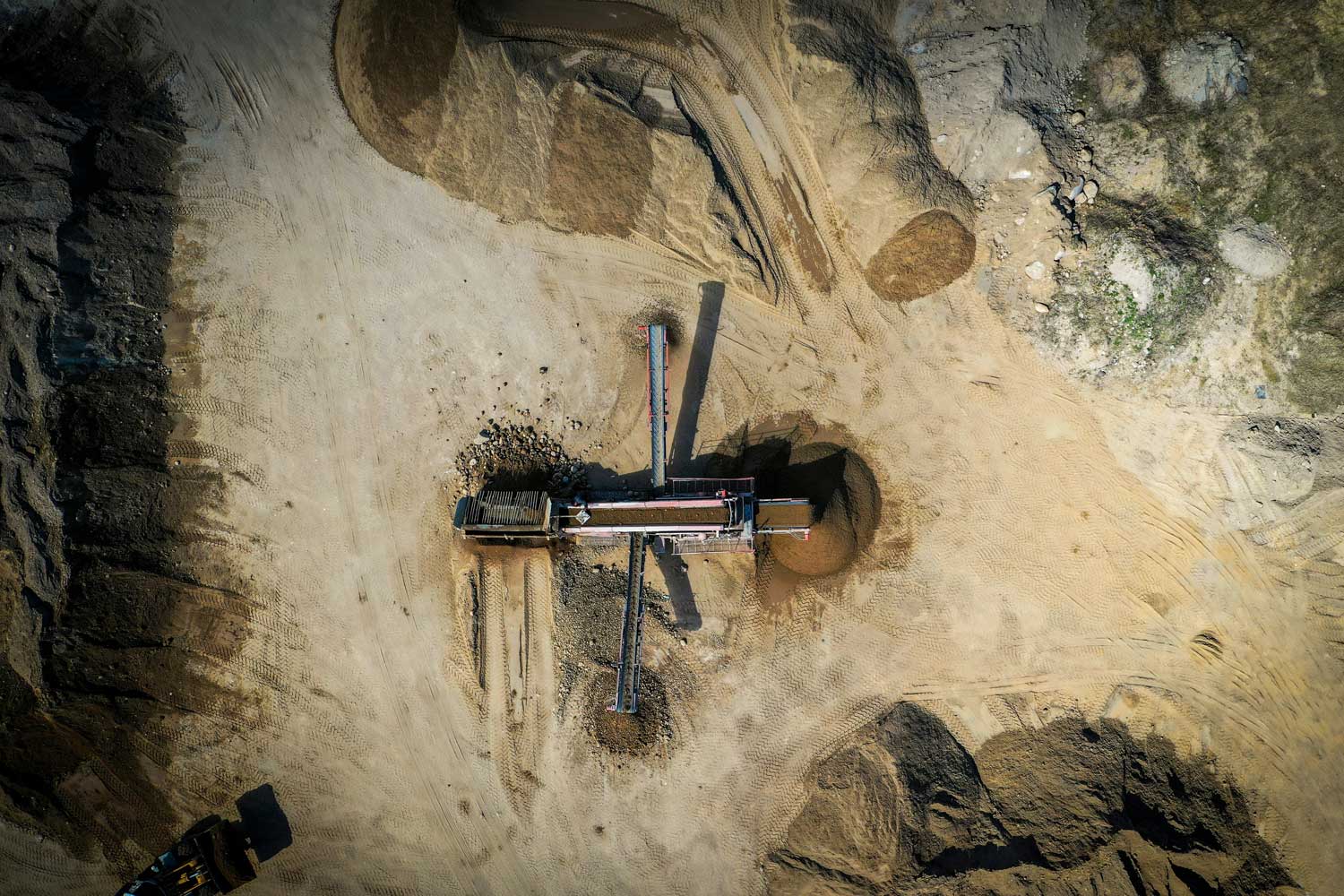
Why Volumetrics

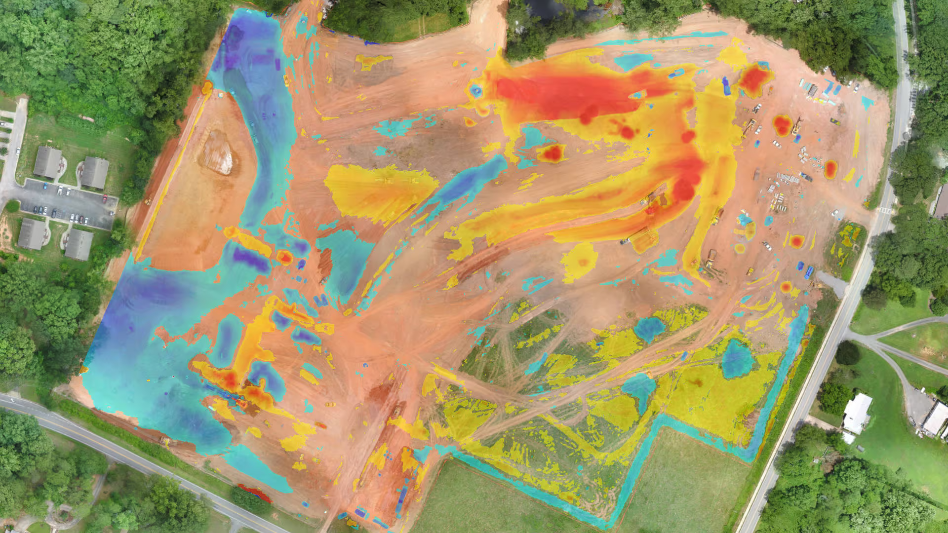
Survey-grade Accuracy
High-resolution 3D models deliver precise volume calculations for stockpiles, cut/fill, and material movement — supporting confident decisions at every stage.

Save Time on Site
Capture large or active sites quickly with UAV data, reducing the need for repeated ground surveys while maintaining accuracy.

Consistent, repeatable reporting
Standardized workflows ensure volumes are calculated the same way every time — ideal for progress tracking, audits, and stakeholder reporting.

Actionable outputs
Receive clear volume reports, surfaces, and datasets formatted for CAD, GIS, and project management tools — ready to use without extra cleanup.
How We Deliver Your Volumetrics
The workflow that turns aerial capture into accurate, repeatable volume reports—ready for estimating, tracking, and billing.
01
Step_01
Planning & Control Setup
We confirm your measurement goals (stockpiles, cut/fill, pits, bins) and define the boundary areas, reporting format, and accuracy needs. If you have ground control points or site benchmarks, we incorporate them to tighten precision and align to your coordinate system.
02
Step_02
Data Capture
Our team captures high-overlap aerial imagery and/or LiDAR optimized for surface modeling. Flights are designed to reduce shadows and occlusions and to ensure complete coverage of every pile, slope, and work zone.
03
Step_03
Processing & Surface Generation
Captured data is processed into a georeferenced point cloud and clean surface model (DSM/DTM depending on the use case). We validate alignment, remove noise, and generate consistent surfaces suitable for measurement and comparison.
04
Step_04
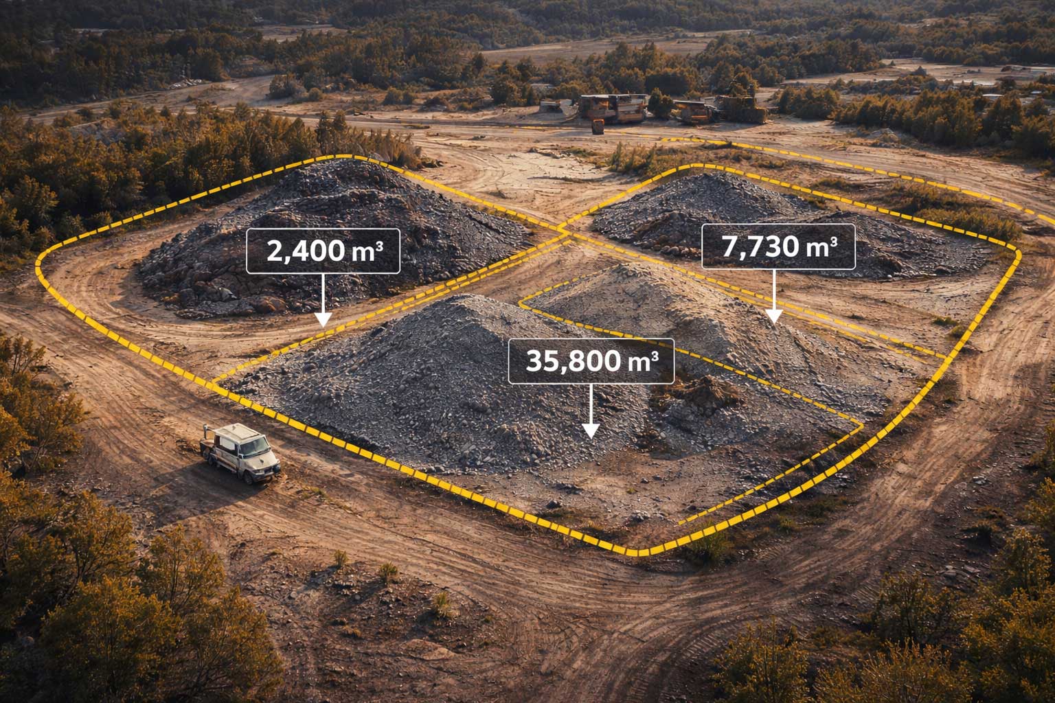
Volume Calculations & Reporting
We calculate volumes using the correct method for your site (TIN surfaces, base plane, previous surface, or design grade). Deliverables include clear volume summaries, annotated visuals, and export files for CAD/GIS—so your team can plug results directly into workflows
IT STARTS NOW
Transform your ideas into results
Share your vision with us, and we’ll create the path to make it real.
ContactApplications
Where Volumetric Data Delivers Real Value
From daily operations to long-term planning, volumetric analysis turns aerial data into measurable insight you can act on—quickly and confidently.
From daily operations to long-term planning, volumetric analysis turns aerial data into measurable insight you can act on—quickly and confidently.
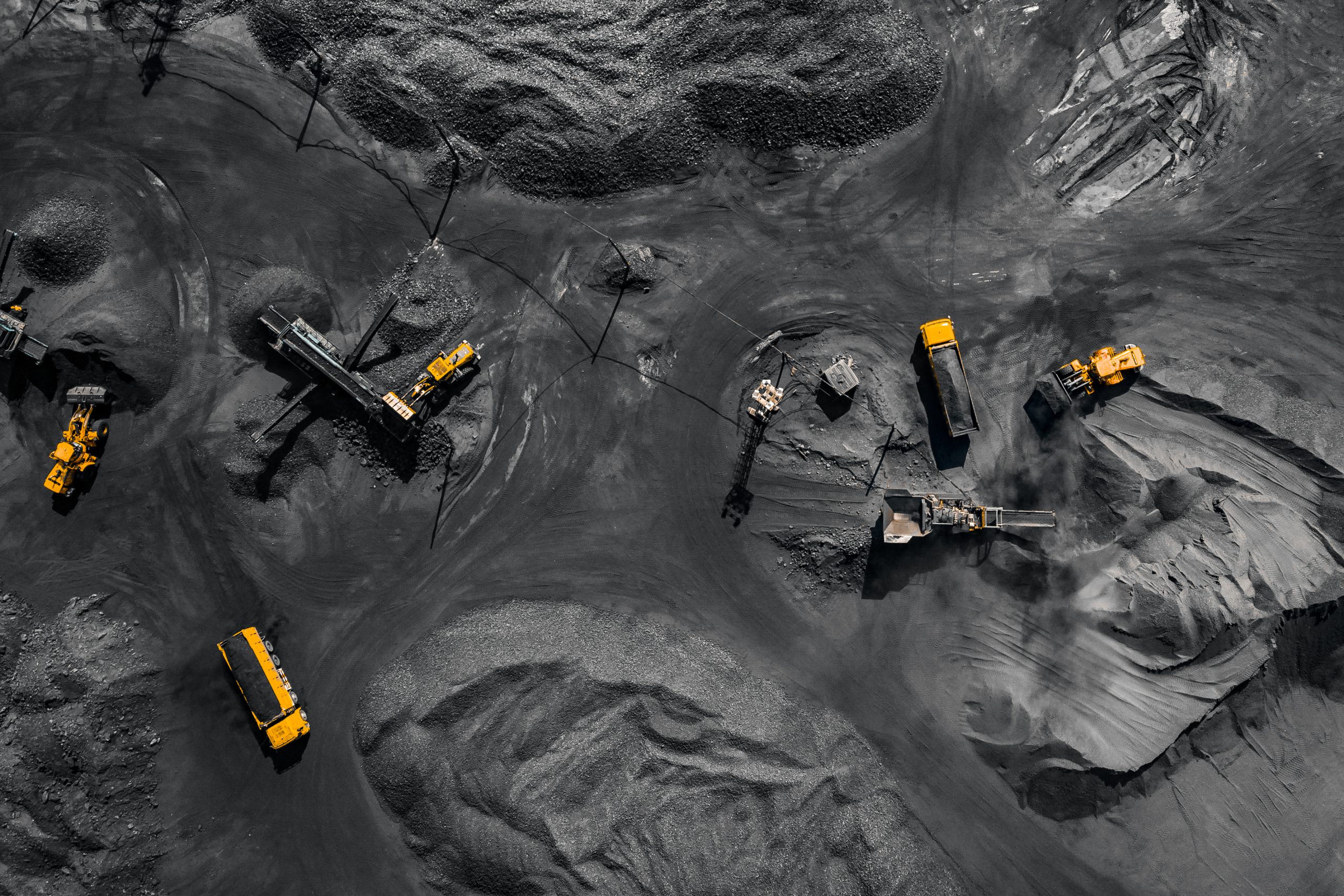
Stockpile Management
Track material volumes accurately across gravel, sand, aggregate, coal, and bulk materials. Reduce manual surveys while improving inventory confidence.
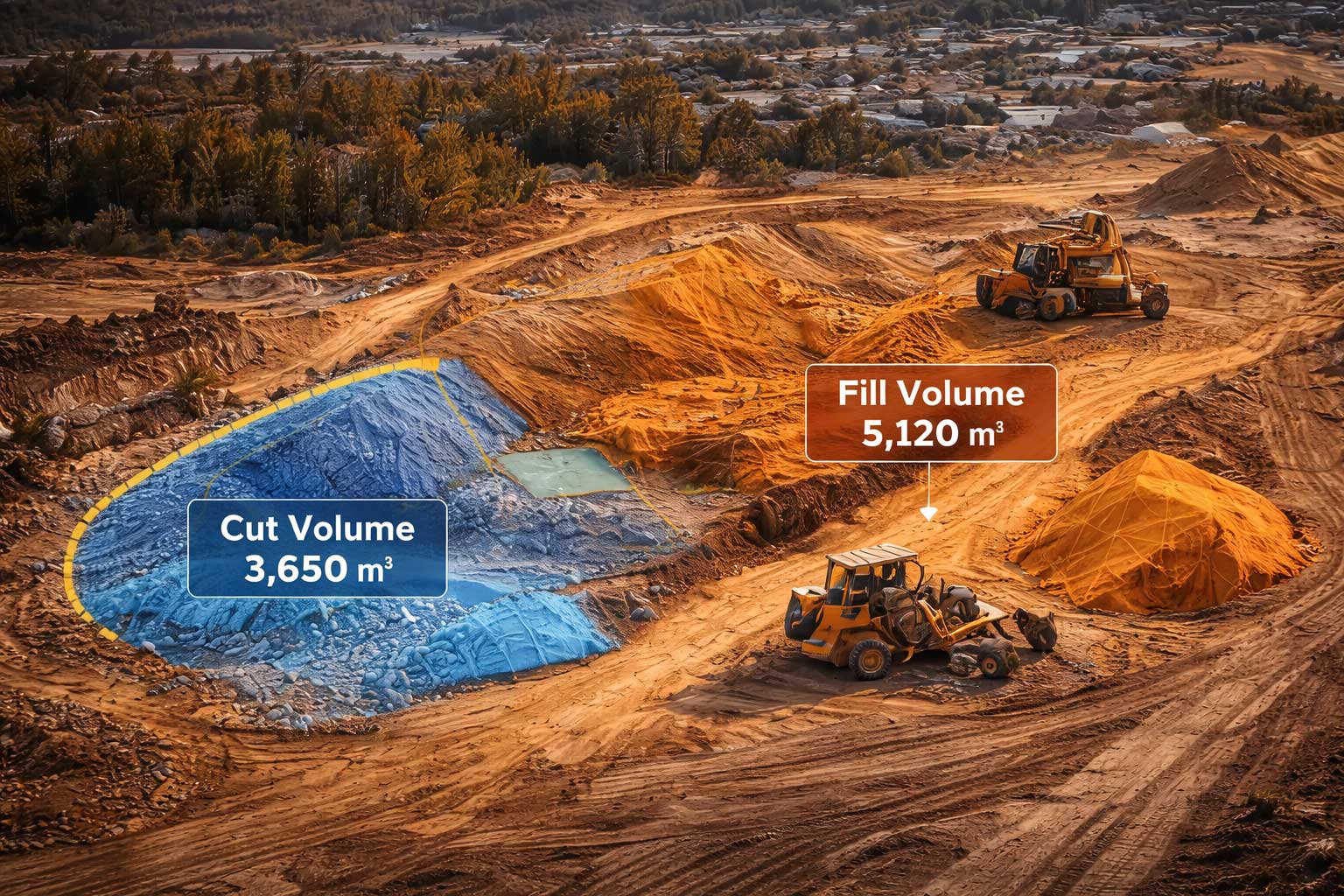
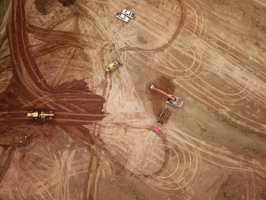
Earthwork & Cut/Fill Analysis
Measure excavation and fill quantities to validate progress, manage costs, and support contractor verification throughout construction phases.
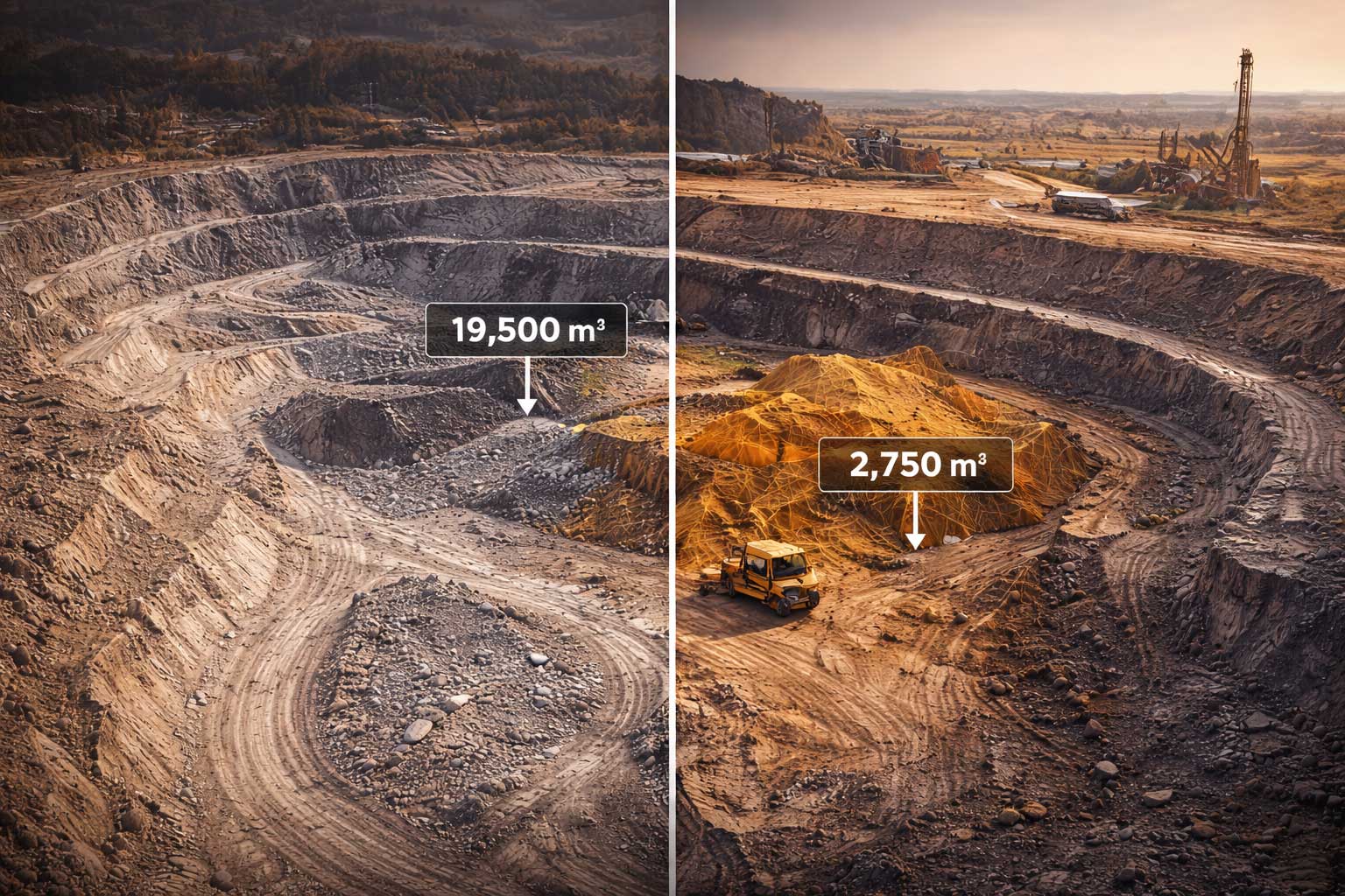
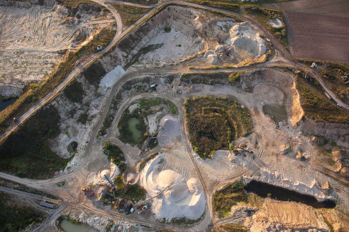
Mining & Quarry Operations
Monitor pit volumes, bench changes, and production outputs with repeatable measurements that improve planning, safety, and reporting.
Construction Progress Verification
Validate quantities moved between phases, document pay applications, and maintain a clear record of site change over time.

Environmental & Waste Monitoring
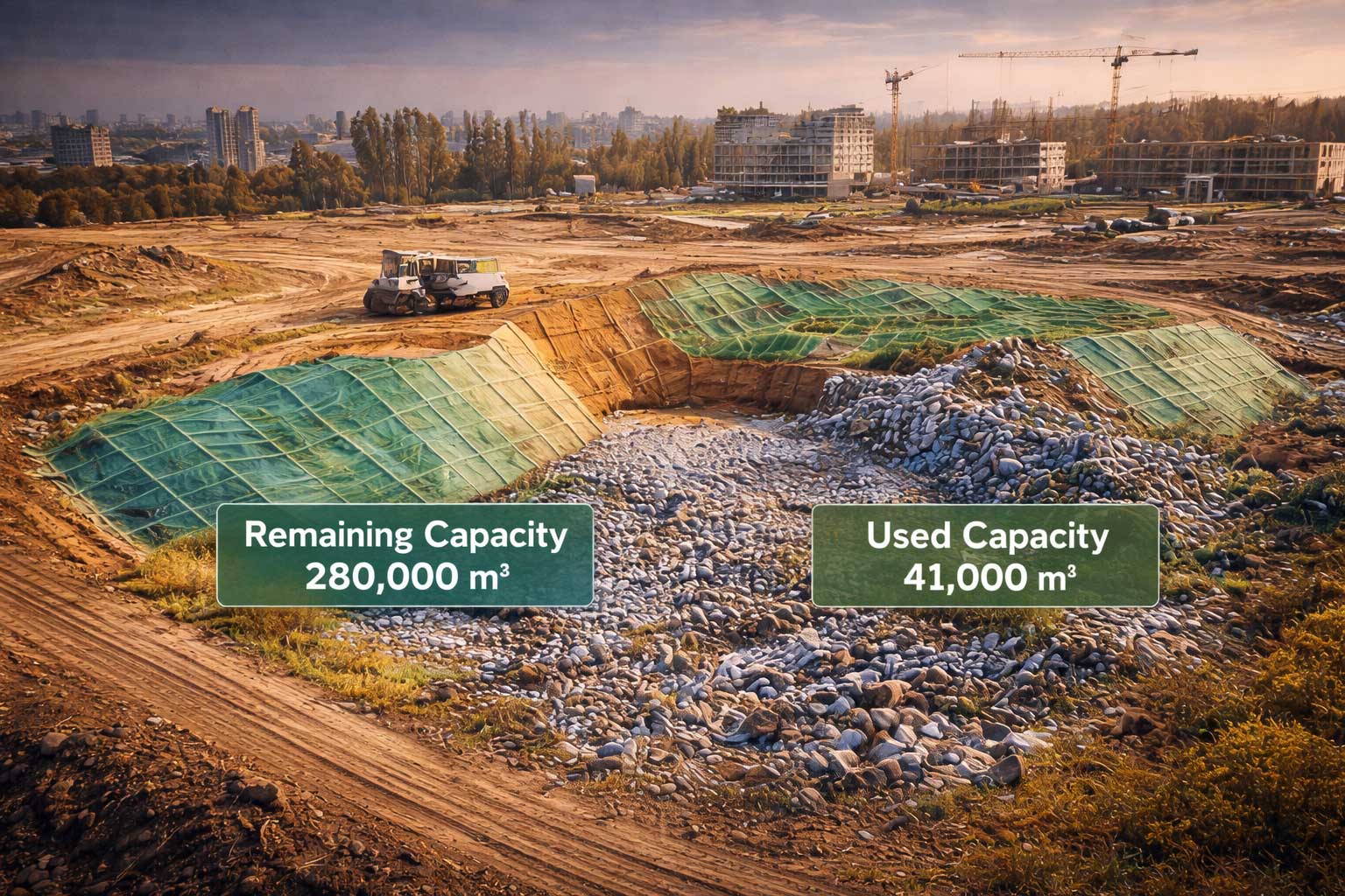
Measure landfill capacity, soil movement, and remediation progress with accurate volume calculations and consistent reporting.
Volumetrics FAQs
Answers to common questions about volumetric accuracy, reporting methods, and how aerial volume calculations support construction, mining, and operations.
How long does it take to receive volumetric results?
.svg)
What deliverables will I receive?
How are volumes calculated?
What types of volume calculations do you provide?
How accurate are aerial volumetric measurements?
What are volumetrics?
IT STARTS NOW
Transform your ideas into results
Share your vision with us, and we’ll create the path to make it real.
Thank you! Your submission has been received!
Oops! Something went wrong while submitting the form.