
.svg)
Real-Time Aerial Insights
Track Every Stage of Your Project with Accurate, Up-to-Date Aerial Insights

Clarity at Every Stage
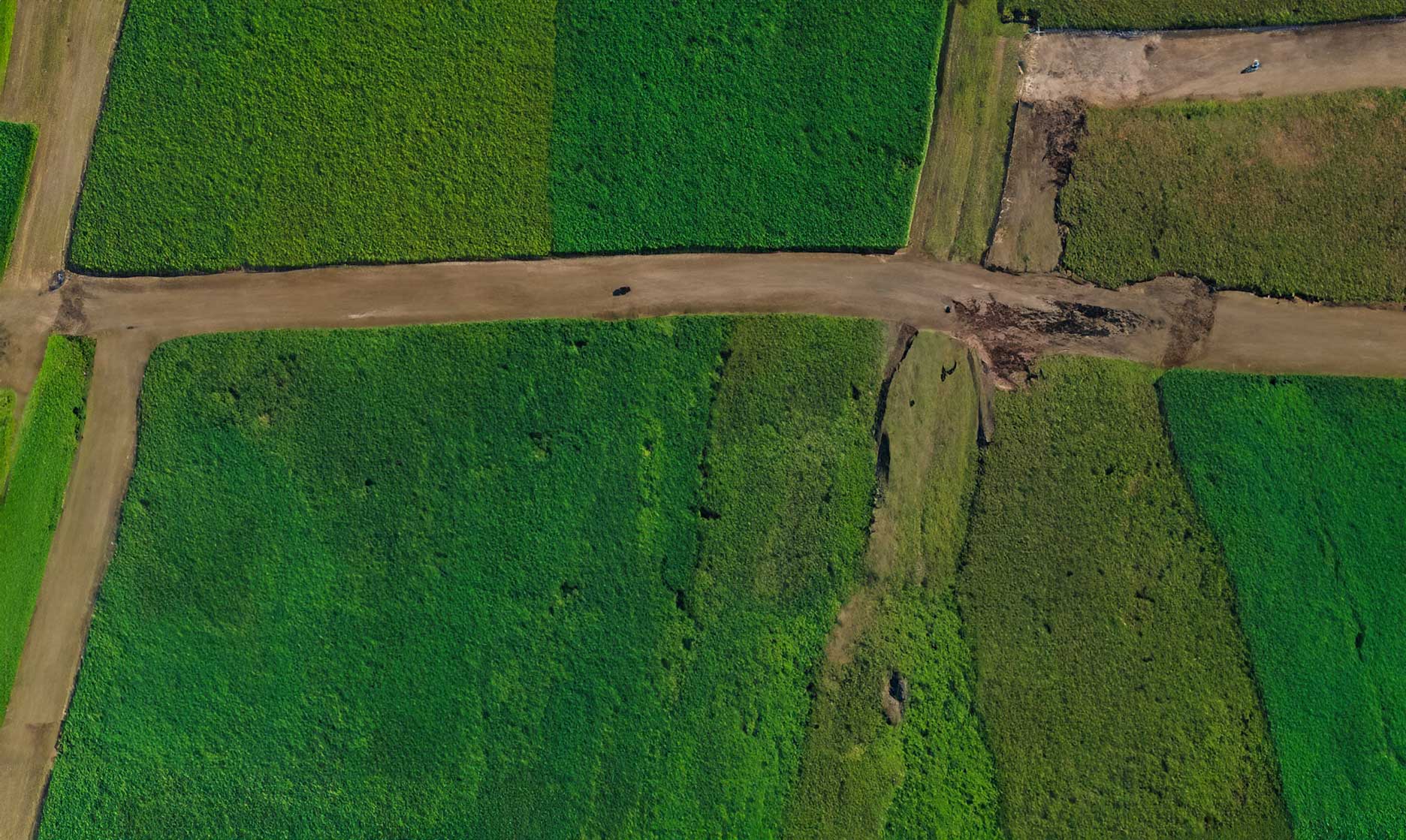
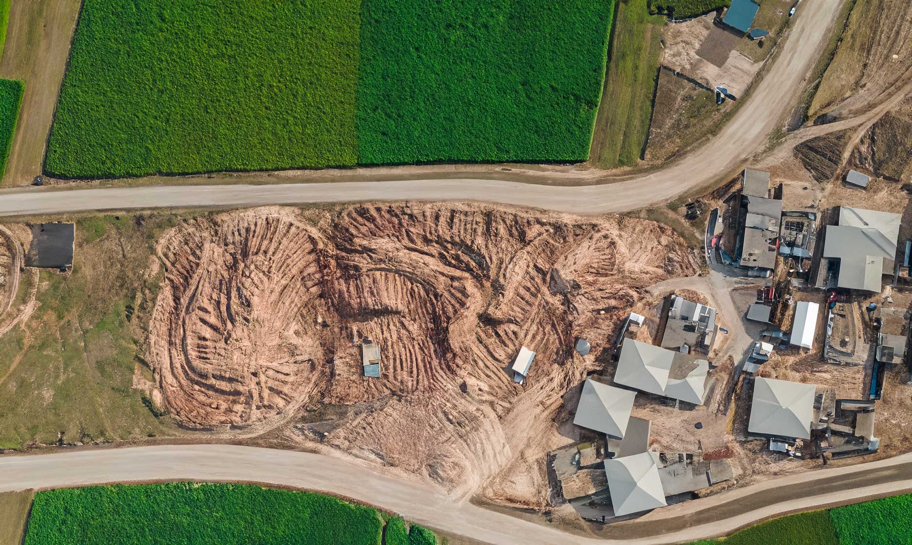
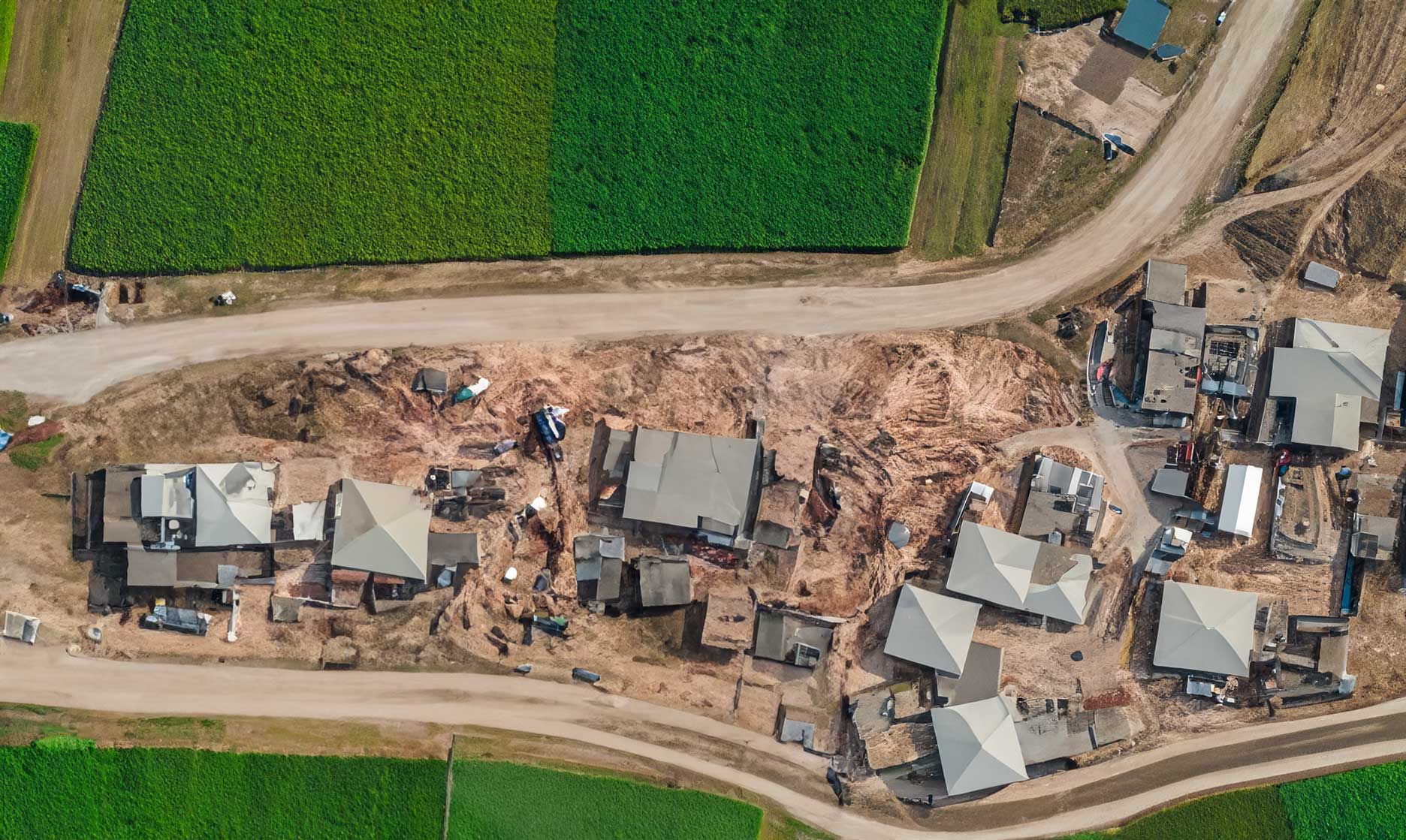
High-resolution aerial imagery gives you a complete picture of your project’s progress. From earthwork to final build, track updates, verify milestones, and share visual reports that keep everyone aligned.
Submit Your Site Details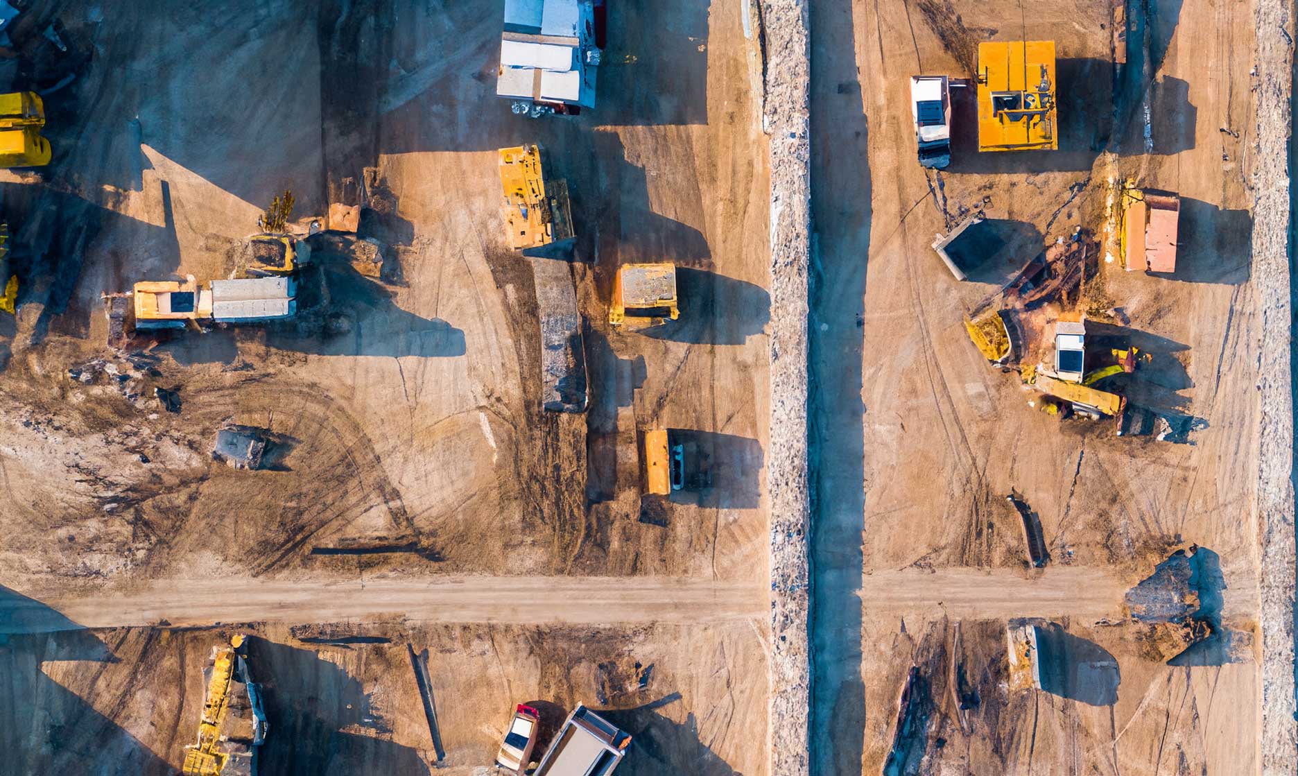
Why Progress Monitoring
.png)
Consistent Visibility
Gain a clear, continuous view of your project’s evolution. Our drone imagery captures progress at every phase—so you can verify work, track milestones, and communicate updates with ease.

Precise Tracking
Align each new capture with previous data to measure change over time. From earthworks to finished structures, identify deviations early and keep projects on schedule.

Simple Sharing
Share high-resolution visuals and progress maps with stakeholders instantly. Keep teams, clients, and partners aligned through clear, visual documentation.

Fast Delivery
Receive processed imagery and reports within days, allowing you to make timely, data-driven decisions that keep your operations moving forward.
Civil & Surveying
Capture large sites with survey-grade accuracy to support planning, design, and compliance.
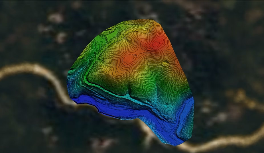
High-resolution Digital Elevation Models (DEMs)
Contour maps for site planning
Surface & terrain analysis
Utility and roadway mapping
Construction
Monitor progress and maintain project accuracy with frequent LiDAR scans.
As-built verification models
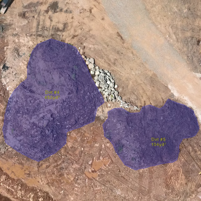
Cut/fill calculations
Stockpile volumes
Change detection over time
Mining & Aggregates
Improve safety and operational efficiency with precise mine and quarry data.
Volumetric stockpile reports
Pit wall and slope stability analysis
Detailed surface TINs/contours
Production tracking
Environmental & Natural Resources
Generate accurate terrain and vegetation data to support conservation and land management.
Vegetation height models
Floodplain mapping
Erosion and watershed studies
Habitat and forestry analysis
Aerial Progress Monitoring for Every Site
Track construction and infrastructure projects with precision. Our drone imagery captures consistent, high-resolution visuals that document progress, verify milestones, and keep your team aligned from start to finish.
High-Resolution Progress Deliverables
- Crystal-clear aerial imagery and video documenting every stage of construction
- Compare progress over time with consistent, geo-referenced datasets
- Visual proof for reporting, stakeholder updates, and quality assurance
3D Modeling & Ongoing Site Analysis
- Create accurate 3D site models to measure change and track milestones
- Assess earthwork volumes, structural placement, and overall project status
- Ideal for planning, verification, and project documentation
Notice the difference: Drone-based progress monitoring gives you a reliable, repeatable record of each phase—without disrupting on-site operations. With Databird, you gain the clarity to plan ahead, share updates, and make confident decisions every step of the way.
Progress Intelligence at Scale
From individual sites to multi-location projects—one unified monitoring workflow.
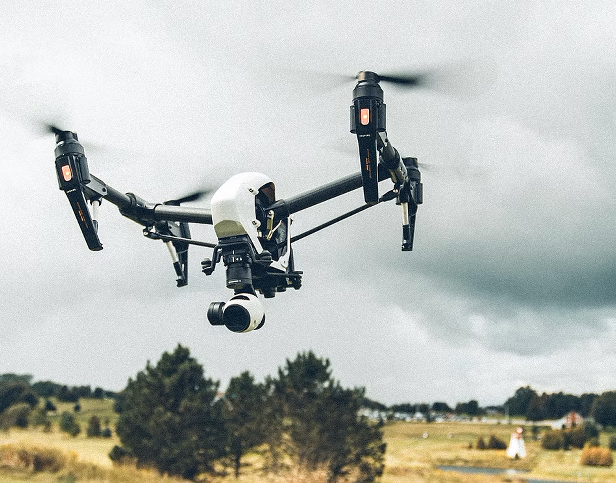
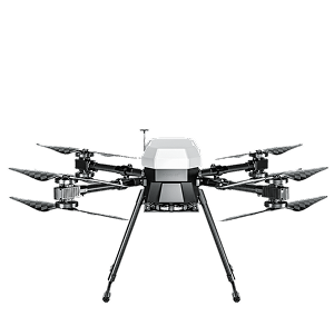
multicopter drone
100’s acres
Efficient capture with multicopter drones for small-to-mid sized sites.
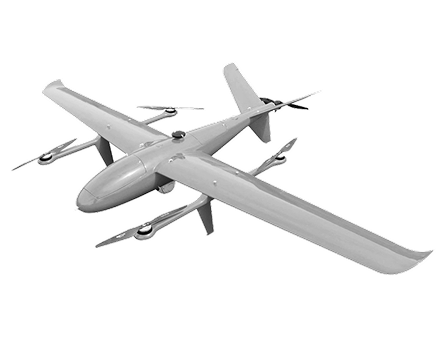
VTOL drone
1000’s acres
Efficient capture with multicopter drones for small-to-mid sized sites.
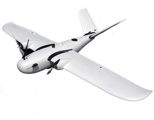
Airplane drone
10,000’s acres
Efficient capture with multicopter drones for small-to-mid sized sites.
How We Monitor Your Project
The progress monitoring workflow that powers your project. See how aerial data turns into measurable progress and actionable insight.

01
Step_01
Planning & Scheduling
We start by understanding your project goals, timeline, and key milestones. Using Progress Monitoring Pro, we define capture frequency, flight paths, and camera settings to ensure consistent, comparable results throughout the build.
02
Step_02
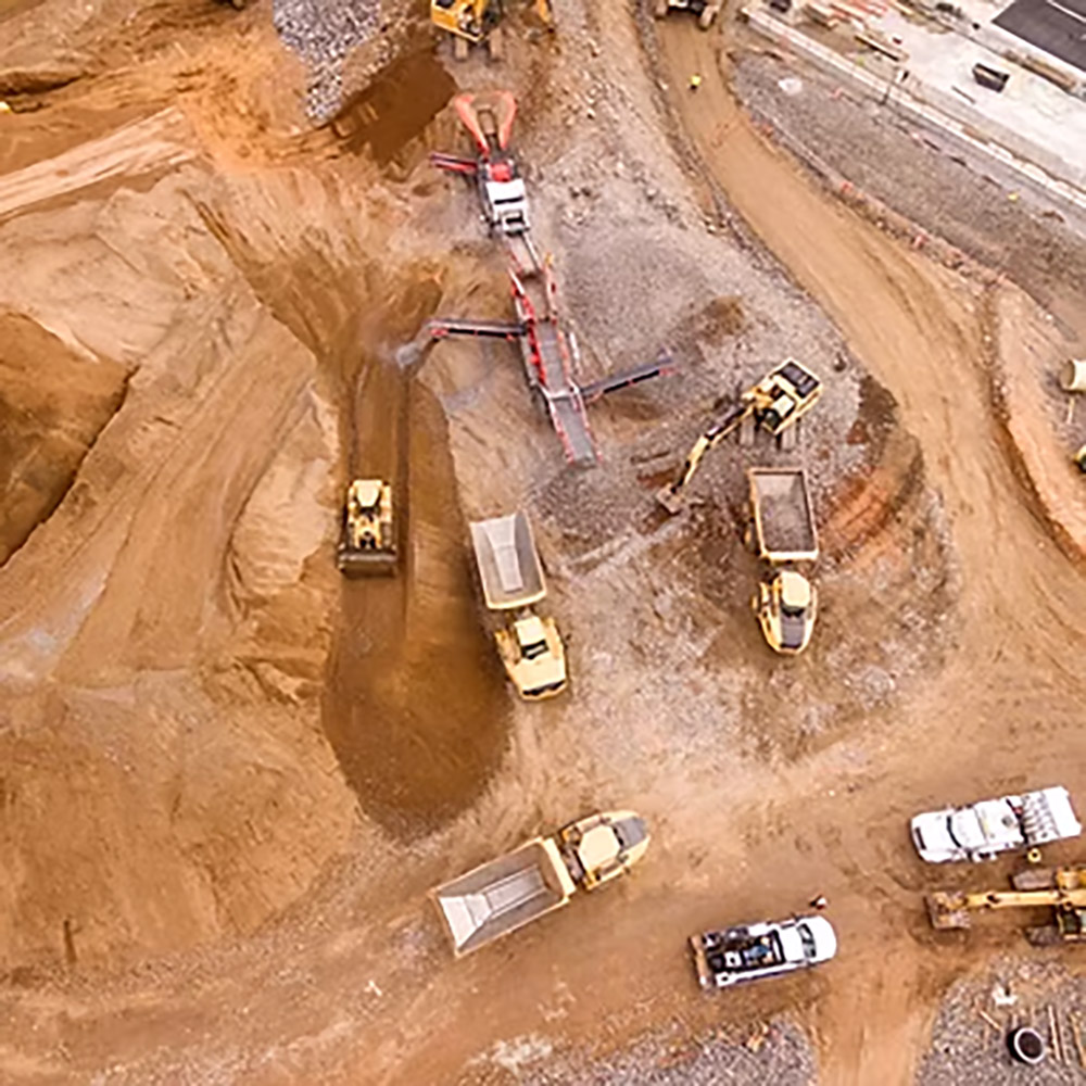
Aerial Data Capture
Our drones collect high-resolution imagery and video across your site—covering every structure and surface with precision. Each flight is optimized for alignment, overlap, and lighting to deliver clear, repeatable visual records.
03
Step_03
Processing & Analysis
Captured data is processed through Databird’s workflow for orthomosaic generation, 3D modeling, and change detection. We align each capture with previous datasets to visualize progress and verify work completed.
04
Step_04
Reporting & Delivery
We provide processed imagery, side-by-side comparisons, and visual progress reports in easy-to-share formats. Get the clarity you need to make informed decisions, document progress, and keep every stakeholder aligned.
IT STARTS NOW
Transform your ideas into results
Share your vision with us, and we’ll create the path to make it real.
ContactIndustries
Civil and Surveying
Deliver high-accuracy topographic maps, digital elevation models, and geospatial data that streamline surveying workflows, reduce field time, and support smarter design decisions.
High-resolution Digital Elevation Models (DEMs)
Contour maps for site planning
Surface & terrain analysis
Utility and roadway mapping
Construction
Monitor progress and maintain project accuracy with frequent LiDAR scans.
As-built verification models
Cut/fill calculations
Stockpile volumes
Change detection over time
Mining & Aggregates
Improve safety and operational efficiency with precise mine and quarry data.
Volumetric stockpile reports
Pit wall and slope stability analysis
Detailed surface TINs/contours
Production tracking
Environmental & Natural Resources
Generate accurate terrain and vegetation data to support conservation and land management.
Vegetation height models
Floodplain mapping
Erosion and watershed studies
Habitat and forestry analysis
Progress Monitoring FAQs
Get answers to the most common questions about aerial progress tracking — from capture frequency and deliverables to accuracy and turnaround time.
Can the data integrate with my existing software?
.svg)
How quickly will I get my results?
How accurate is the progress data?
What deliverables will I receive?
How often should progress flights be scheduled?
IT STARTS NOW
Transform your ideas into results
Share your vision with us, and we’ll create the path to make it real.
Thank you! Your submission has been received!
Oops! Something went wrong while submitting the form.